Visitors have been flocking to Hot Springs National Park for decades for its healing waters. What surprises many park visitors is that there are a staggering 26 miles of trails packed in America's second smallest National Park. We hope this Hot Springs National Park hiking guide helps you plan your time in the park.
Hot Springs National Park Hiking
This is a pretty good feat as the smallest (Gateway Arch National Park) is more of an urban park in a city without any hiking trails, well except hiking to and from your car.
The best way to describe hiking at Hot Springs National Park is that there are numerous small interconnected trails. This means that hikers should definitely carry a map and their 10 essentials with them on their hike. There are also several steep grades so you should also wear appropriate clothing and shoes, stay on established trails, and remember that wildlife is often seen on trails including bears.
The Park and its trails are separated into two different sections by downtown Hot Springs. The Core of the park is "Bathhouse row". This is where you will find the parks visitor center at the Fordyce bathhouse, The Superior Bathhouse Brewery at the Superior Bathhouse, and you can take a bath at the Buckstaff Bathhouse.
After visiting Bathhouse Row, I highly suggest visitors explore the North Mountain Area. This is where you will find the scenic Hot Springs Mountain Drive, the Hot Springs Mountain Tower, the Gulpha Gorge Campground, and the majority of the parks trails including the breathtaking Grand Promenade.
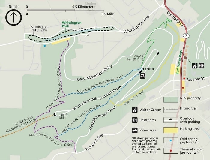
The West Mountain Hiking Trails are easily accessible on the scenic West Mountain Scenic Drive or by taking the canyon trail off of Central Avenue.
Hot Springs National Park and North Mountain Hiking Trails
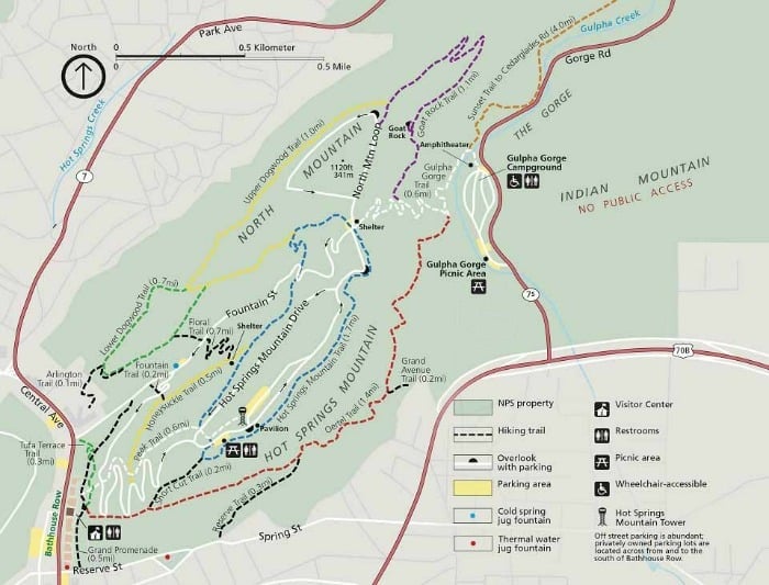
Fountain Trail
- Distance: 528 ft
- Grade: 9.8%
This short trail begins on Fountain Street with a steep ascent and takes you to the Honeysuckle Trail.
Arlington Trail
- Distance: 0.1 mile
- Grade: 2.5%
This short trail starts at the seventh-floor pool area of the Arlington hotel and takes you to the Lower Dogwood Trail.
Grand Avenue Trail
- Distance: 0.2 mi
- Grade: 4.7%
This is a connector trail from Grand Avenue just south of a local motel to the Oertel Trail
Shortcut Trail
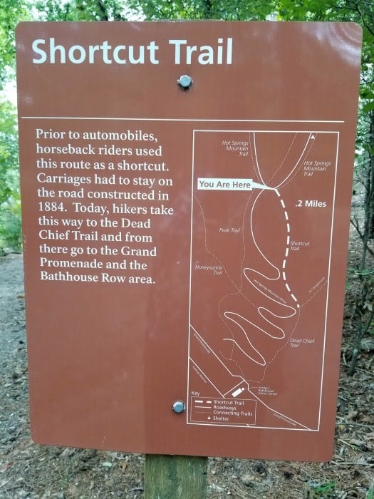
- Distance: 0.2 mile
- Grade: 21.1%
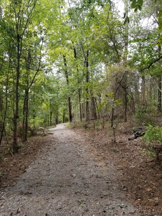
The Short Cut Trail is a short cut between Oertel Trail and the Hot Springs Mountain picnic area.
Tufa Terrace Trail
- Distance: .3 mile
- Grade: 6%
This trail starts at the Arlington lawn near the corner of Bathhouse Row and Fountain Street near the hot water cascade and ends above the Grand Promenade at Stevens Balustrade.
Reserve Trail
- Distance: .3 mile
- Grade: 5.7%
This trail begins at Reserve Street, just beyond a series of duplexes and a stately white building and connects the Oertel Trail with Spring Street with Reserve Street.
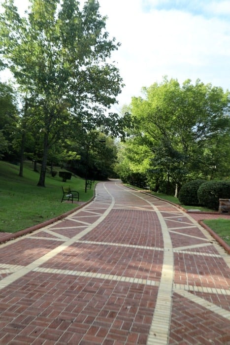
Grand Promenade
- Distance: .5 mile
- Grade: 3.7%
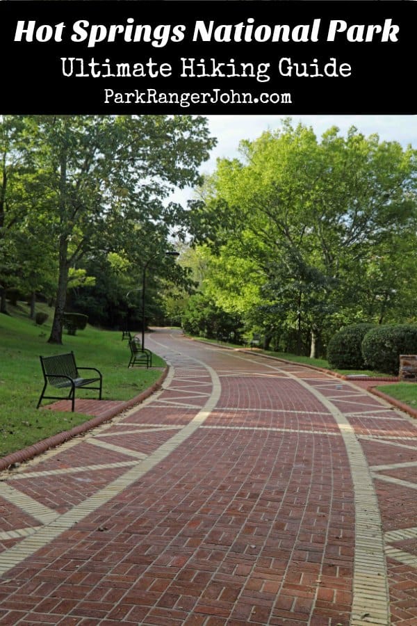
If you only take one trail in Hot Springs, make it the Grand Promenade. It's not your typical walk in the woods but will most certainly be a trail you always remember! This beautiful brick trail runs parallel with Central Avenue behind Bathhouse Row and goes from Reserve Street to Fountain Street. There are also several other trails you can access from here.
Park Ranger John Pro Tip:
The Grand Promenade is a trail to enjoy. Stop at one of the several park benches or bring your checkers and stop at one of the checkers tables and just enjoy a few games outdoors! The trail also offers several overlooks that have great views of Bathhouse Row.
If you like fall colors, you will fall in love with Hot Springs! Taking a hike will put you in the middle of nature's magic in the fall.
Honeysuckle Trail
- Distance: .5 mile
- Grade: 5.4%
The Honeysuckle Trail connects Peak Trail with Hot Springs Mountain Trail.
Peak Trail
- Distance: .6 mile
- Grade: 12.6%
The Peak Trail begins at Tufa Terrace Trail above the Grand Promenade and steeply ascends Hot Springs Mountain to the Hot Springs Mountain Tower.
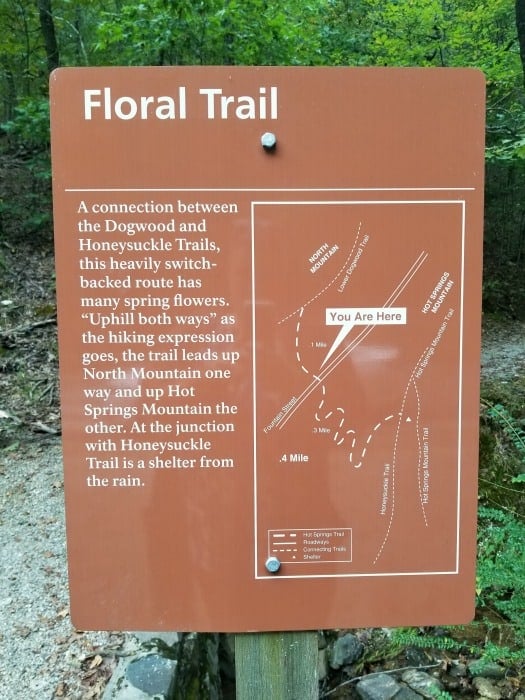
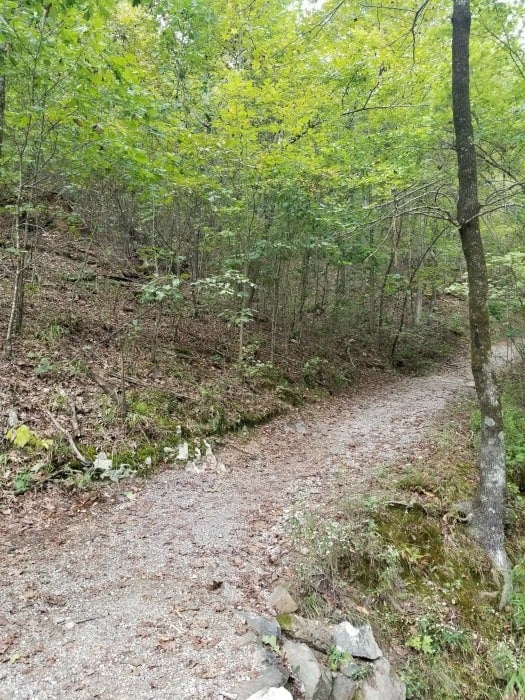
Floral Trail
- Distance: .7 mile
- Grade: 4.1%
The trailhead starts on Hot Springs Mountain Drive, 50 yards past Happy Hollow jug fountain. Floral Trail connects Lower Dogwood Trail and Honeysuckle Trail.
Lower Dogwood Trail
- Distance: .7 mile
- Grade: 4.6%
The trailhead for the Lower Dogwood Trail starts by taking a left at the east end of Arlington Trail. Lower Dogwood Trail climbs North Mountain.
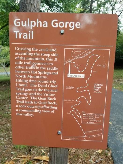
Gulpha Gorge Trail
- Distance: .8 mile
- Grade: 13.8%
The trailhead starts at the Gulpha Gorge Campground and connects to many of the park trails. This trail starts off steep heading west from the campground.
Upper Dogwood Trail
- Distance: 1.0 mile
- Grade: 4.8%
The Upper Dogwood Trail starts at the overlook on North Mountain.
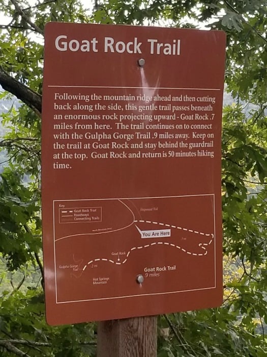
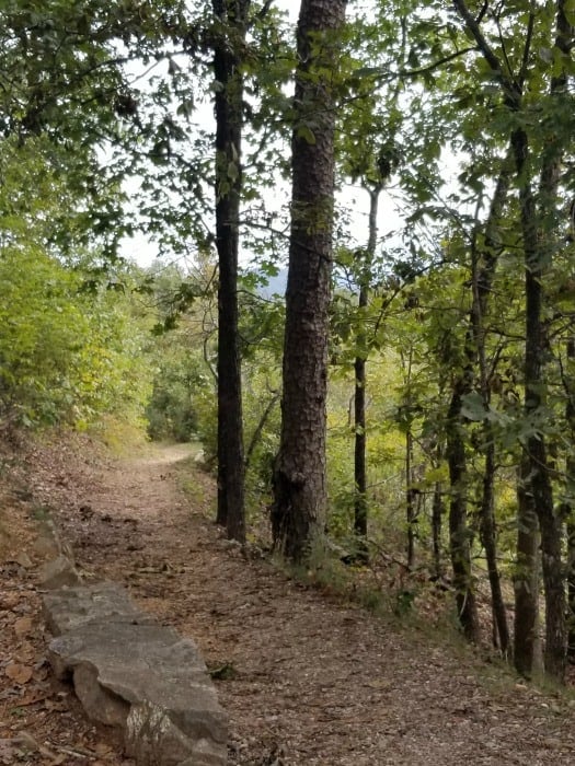
Goat Rock Trail
- Distance: 1.1 mile
- Grade: 3.2%
This is a nice trail leading out to a beautiful lookout at Goat Rock. The trail had some shade but also a lot of sun. Limited parking is available at the overlook on North Mountain
Dead Chief Trail
- Distance: 1.4 mile
- Grade: 7%
The Dead Chief Trailhead starts at the Army-Navy gate above the Stevens Balustrade. This trail eventually intersects with Gulpha Gorge Trail for the easiest walk (1.6miles) from Bathhouse Row to the park campground. At first quite steep, the trail levels off and follows the contour of Hot Springs Mountain towards Gulpha Gorge.
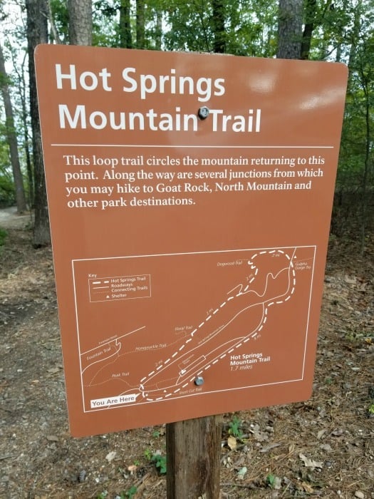
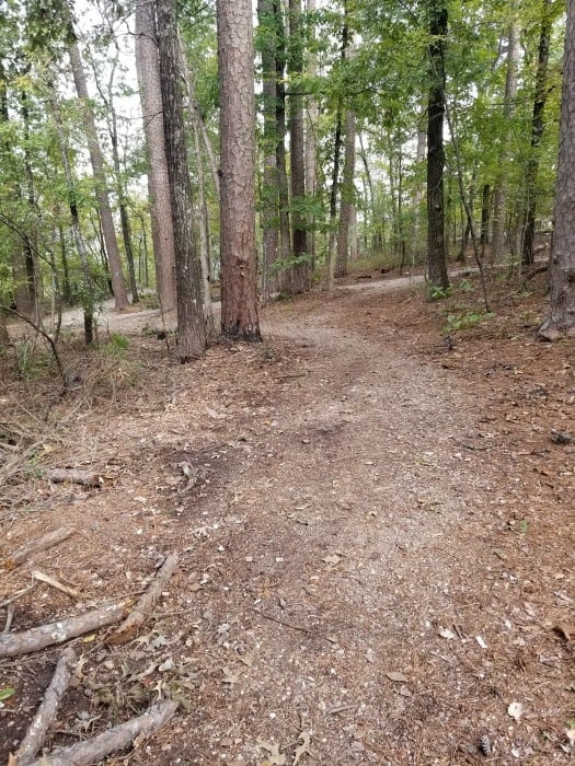
Hot Springs Mountain Trail
- Distance: 1.7 mile
- Grade: .5%
The Hot Springs Mountain Trail walk begins at the Pagoda shelter just below the Hot Springs Mountain Tower. Here you will find several scenic overlooks as you take a hike around the top of the mountain.
Hot Springs National Park West Mountain Hiking Trails
Hiking trails are sorted by distance
Canyon Trail
- Distance: .7 mile
- Grade: 10%
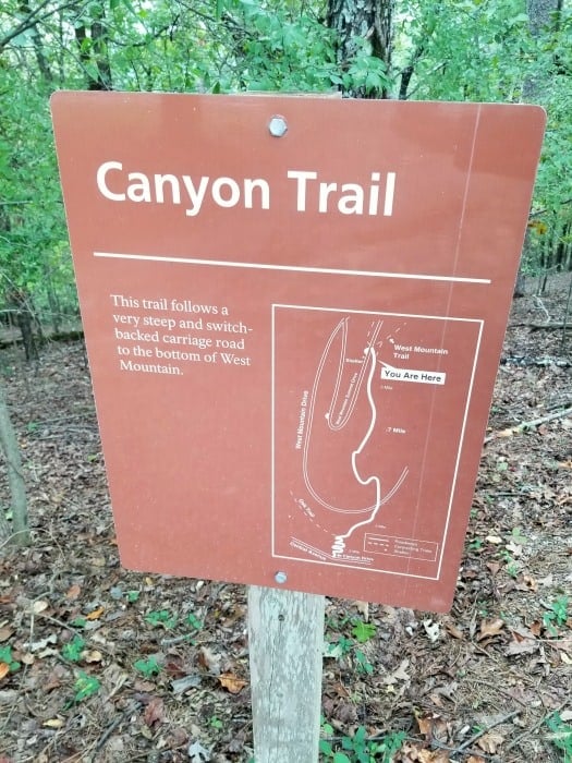
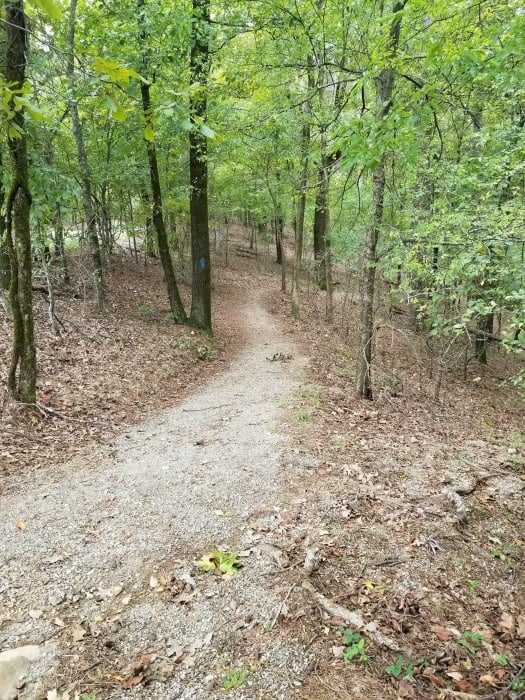
The Canyon Trail trailhead is behind the Mountain Valley Water building. The section between West Mountain Drive and West Mountain Trail is very steep.
Oak Trail
- Distance: 1.0 mile
- Average grade - 4.2%
The Northeastern end of Oak Tail is mainly flat, the trail is fairly steep for a short distance between West Mountain Trail and West Mountain Drive.
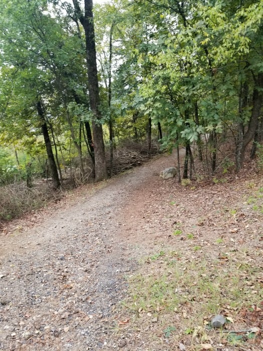
West Mountain Trail
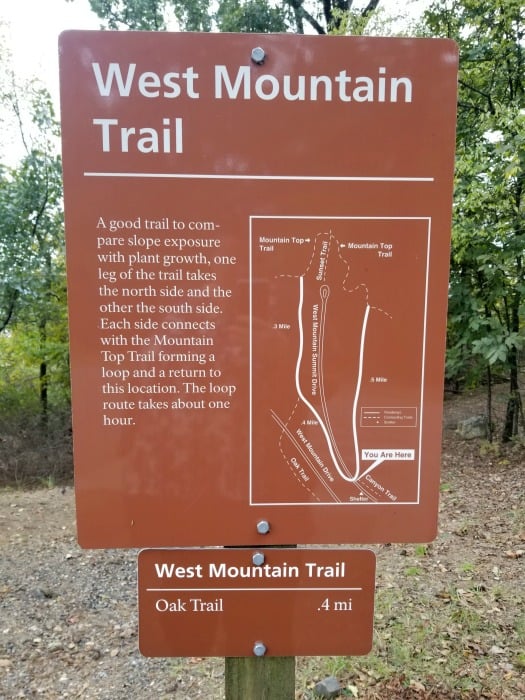
- Distance: 1.2 mile
- Grade - 1.1%
You can turn West Mountain Trail into a loop by using the Mountain Top Trail
Whittington Trail
- Distance: 1.2 mile
- Grade .6%
This trail is a flat gravel trail that loops around Whittington Park right before turning up the hill of West Mountain Summit Drive.
Mountain Top Trail
- Distance: 1.5 mile
- Grade - 5.4%
If hiking southward, the trail is strenuous, as it gains elevation quickly. If hiking northward, there is a steady rise in elevation until you cross Sunset Trail; the trail descends steeply to the trailhead at Whittington Park.
Sunset Trail
- Distance - 10 miles
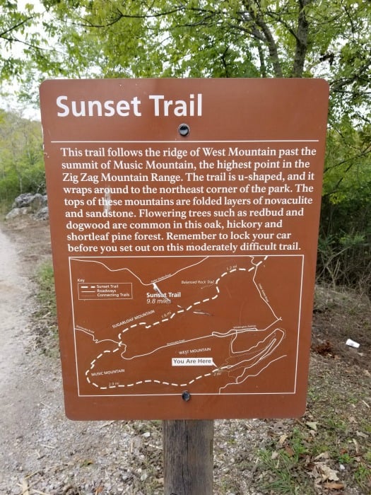
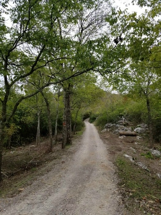
Sunset Trail is the longest trail in Hot Springs National Park, covering approximately 10 miles one-way. The Sunset trail is divided into three sections: West Mountain section is 2.8 miles, the Sugarloaf Mountain section is 2.6 miles, and the Stonebridge Road section is 3.8 miles. Sunset Trail can be combined with Hot Springs and North Mountain trails and West Mountain trails to complete a strenuous 15-17-mile loop hike.
Learn more about National Park Passes for parks that have an entrance fee.
$80.00 - For the America the Beautiful/National Park Pass. The pass covers entrance fees to all US National Park Sites and over 2,000 Federal Recreation Fee Sites for an entire year and covers everyone in the car for per-vehicle sites and up to 4 adults for per-person sites.
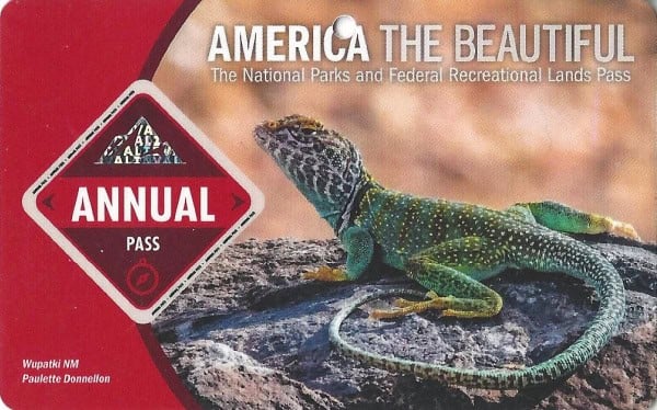
Buy your pass at this link, and REI will donate 10% of pass proceeds to the National Forest Foundation, National Park Foundation, and the U.S. Endowment for Forestry & Communities.
National Park Free Entrance Days -Mark your calendars with the five free entrance days the National Park Service offers annually.
Directions to popular trails - Here are road directions for popular spots in the park.
Hot Springs National Park Lodging
There are no National Park Lodges within Hot Springs NP, but Gulpha Gorge Campground and Hotel Hale are both located within the park and offer overnight accommodations.
Embassy Suites by Hilton Hot Springs Hotel & Spa - Take advantage of free full breakfast, a grocery/convenience store, and a free daily manager's reception at Embassy Suites by Hilton Hot Springs Hotel & Spa. Treat yourself to spa services, such as a massage, a manicure/pedicure, or a body scrub. Stay connected with free Wi-Fi in public areas, and guests can find other amenities such as dry cleaning/laundry services and a bar.
The Hotel Hot Springs - A free breakfast buffet, a terrace, and a bar are just a few of the amenities provided at The Hotel Hot Springs. The onsite American cuisine restaurant, Inside Track Grill, features happy hour and light fare. Stay connected with free in-room Wi-Fi, and guests can find other amenities such as a 24-hour business center.
The Waters Hot Springs, Tapestry Collection by Hilton - Consider a stay at The Waters Hot Springs, Tapestry Collection by Hilton and take advantage of a grocery/convenience store, a terrace, and dry cleaning/laundry services. Free in-room Wi-Fi is available to all guests, along with a bar and a gym
TownePlace Suites by Marriott Hot Springs - A fitness center, a seasonal outdoor pool, and a business center are available at this smoke-free aparthotel. Free buffet breakfast, free Wi-Fi in public areas, and free self-parking are also provided. Additionally, dry cleaning, laundry facilities, and a 24-hour front desk are onsite. Each apartment provides a kitchenette with a refrigerator, an oven, a stovetop, and a microwave. For a bit of entertainment, a flat-screen TV comes with satellite channels, and guests can also appreciate conveniences like a sitting area and a coffee/tea maker.
Click on the map below to see current rates for hotels and vacation rentals in Hot Springs, AR.
Additional Resources
Things to do Hot Springs National Park - Check out all of the great things to do in Hot Springs NP
Superior Bathhouse Brewery - Learn more about the brewery located inside the National Park
Hot Springs National Park Camping - Learn more about the Gulpha Gorge Campground
Most Visited National Parks - See where Hot Springs lands on the Most Visited National Park Site list.
Arkansas National Parks - Check out all of the National Parks in Arkansas you can visit
Things to do in Hot Springs Arkansas - all of the epic things to do in town.
Make sure to follow Park Ranger John on Facebook, Instagram, Pinterest, and TikTok



Leave a Reply