Ready to explore 14 Epic Bryce Canyon Hikes? Spending time hiking in Bryce Canyon is perhaps the best way to get out and explore its 35,835 acres!
Once in Bryce Canyon, you will find what appears to be a completely different park than what you see from above!
TL;DR Don’t have time to read the full article? Here are my top finds:
🏨Hotels and Vacation Rentals
📍Tours
🐻 Save time! Buy your National Park Pass before your trip
14 Epic Bryce Canyon Hikes
Bryce Canyon Hiking Tips
Carry plenty of water. It’s essential to stay hydrated out on the trails - aim for one liter for every two to three hours you are hiking.
Stay on the trail. While it may be tempting to play on the hoodoos or follow “social” trails (non-designated trails created by visitors), hikers should stick to the designated trails.
This will ensure that you don’t get lost, and it also helps ward off plant death, erosion, and snake bites!
Wear proper footwear. Hiking boots with good traction and ankle support are your best option, but a good pair of tennis shoes will do in a pinch. Keep in mind that ankle-related injuries are one of the park’s most common injuries.
Be mindful of the elevation. Hiking at high elevations is no joke, and Bryce Canyon sits over 9,000 feet above sea level at some points.
Even easy Bryce Canyon hikes can be extremely exhausting, so listen to your body and take plenty of breaks if you need to. Make sure you leave yourself enough energy to complete the entire hike.
Get an early start. Not only will this help with the heat, but it’ll also give you a little solitude on the trails! Parking lots often fill up by mid-morning, so aim to start your hike around sunrise if you can.
If you need a little more motivation to wake up and get going, the lighting across the canyons is magnificent early in the morning.
Check trail conditions and the weather forecast before heading out. Because of its high elevation, some trails in Bryce Canyon still have snow covering them well into the spring.
In addition, thunderstorms are not uncommon in Utah, so always check the weather before you begin your hike.
What to pack for hiking in Bryce Canyon
Dress in Layers
Temperatures vary greatly throughout the park, so dressing in layers is essential. Plan for cool temperatures in the morning and evening and warmer temperatures throughout the afternoon.
Be prepared for the Heat
Once it does warm up, the heat is no joke. Make sure you have plenty of sunscreen layered up at all times.
The high elevation at certain sections of the park means that the UV index is higher - so don’t ruin your trip with a nasty sunburn!
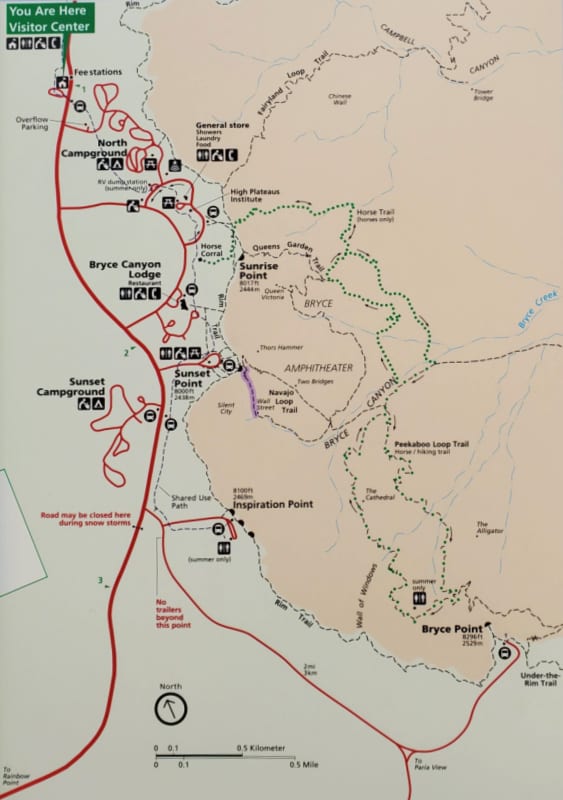
Carry a Bryce Canyon Trails Map
Easy Hikes
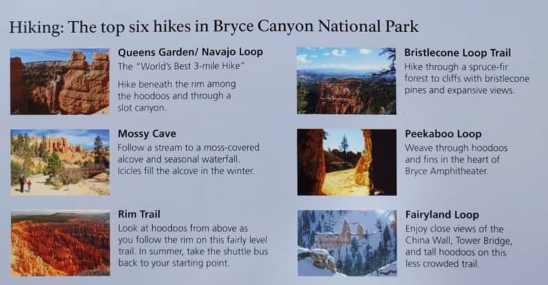
Sunset to Sunrise Trail
- Length: 1 mile
- Elevation Gain/Loss: 40 ft
- Time: 30 Minutes
- Location: Sunset Point
Hiking the Sunset to Sunrise Trail will give you some of the best views with hardly any effort. This paved path runs along the same route as the Rim Trail before splitting off and veering towards Sunrise Point.
This is one of the few Bryce Canyon Hikes that is great for the whole family - from toddlers to grandparents. Even the pups are allowed on this one!
As the name suggests, hiking this trail is great around sunrise or sunset. For the best color show, begin walking a few hours before sunset so you get to see the sun illuminating the canyon walls on its way down.
Rim Trail
- Length: 11 miles
- Elevation Gain/Loss: 1,587 ft
- Time: 5.5 hours
- Location: Bryce Pt Rd or Fairyland Rd
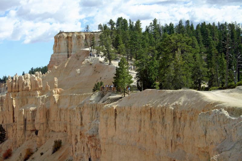
Bryce Canyon’s Rim Trail runs along the perimeter of the canyon and offers incredible aerial views of the hoodoos and amphitheaters below.
This is a unique perspective of the park, as many of the other trails wind through the canyon rather than above it.
While this trail is a fairly easy one, it is long - 5.5 miles one way. Some sections are also fairly steep, but luckily there are plenty of benches along the route if you need a break.
Of course, you could always hike a short section of this long trail if you don’t feel up for an all day hike. The Sunset to Sunrise section (listed above) is a popular route for a shorter version of this stunning trek.
Bristlecone Loop Trail
- Length: 1 mile
- Elevation Gain/Loss: 200 ft
- Time: 1 hour
- Location: Rainbow Point or Yovimpa Point
The Bristlecone Loop Trail is named for the ancient trees that line the trail, the oldest of which is over 1,800 years old! In addition to the old trees, hikers will also get epic views from above the canyon rim.
The Bristlecone Loop trail starts at a higher elevation than any other route in the park.
Luckily, the actual elevation gain is only 200 feet, which makes it easy for hikers of all skill levels. Because of its high elevation, this trail sees some serious snowfall that often lingers into the spring.
Be sure to check trail conditions before heading out to ensure the trail is open and accessible.
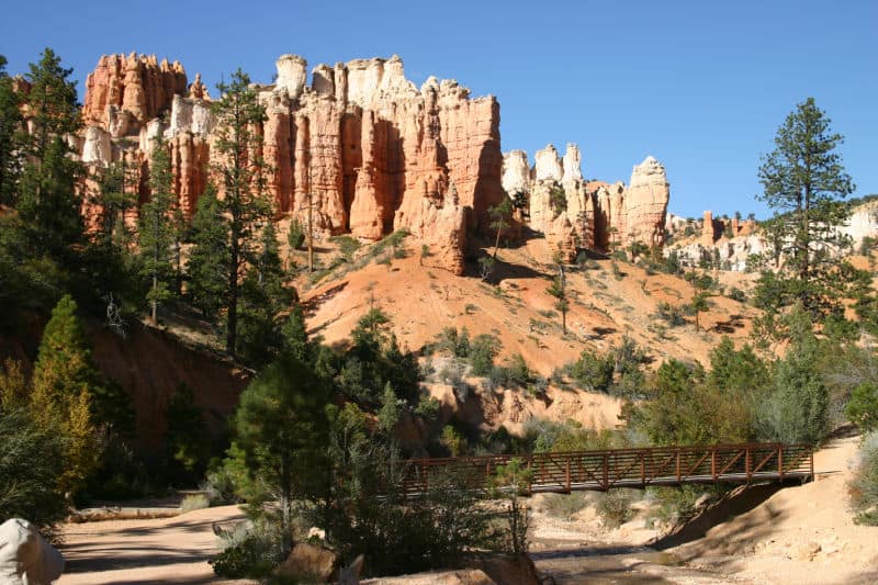
Mossy Cave Trail
- Length: .8 miles
- Elevation Gain/Loss: 450 ft
- Time: 1 hour
- Location: North end of the park (4 miles east on Hwy 12)
Unlike some of the other hiking trails in the park, the Mossy Cave Trail isn’t centered around oddly shaped hoodoos or majestic rim overlooks (though there are plenty of cool rock formations along the way).
As you might have guessed, this short and easy trail leads into a mossy cave, which is actually more of an overhanging shelf than a proper cave.
Before you reach the cave, you’ll meander alongside a stream with towering hoodoos standing sentinel on the hillsides.
The cave itself has a waterfall flowing over its edges in the summer and long icicles hanging down in the winter.
This is a popular hike with a fairly small parking lot. Because parking is not allowed outside the designated lot, you should try to arrive before 10 a.m. if you want to hike Mossy Cave Trail.
Moderate Hikes
Queen’s Garden Loop Trail
- Length: 1.8 miles
- Elevation Gain/Loss: 450 ft
- Time: 1-2 hours
- Location: Sunrise Point
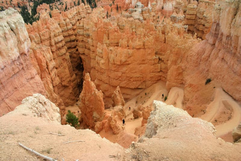
The best way to get up close and personal to the spectacular hoodoos of Bryce Canyon National Park is to venture beneath the canyon’s rim.
The Queen’s Garden Loop Trail is the easiest of the trails that descend under the rim, though there are a few sections that are sure to get the blood pumping.
Once you get to the Queen’s Garden, you can relax on a bench in the shade of the pine trees and marvel at the interesting forms of the hoodoos.
Be sure to search for Queen Victoria - with a little imagination, you can see her sitting on her throne!
Navajo Loop Trail
- Length: 1.3 miles
- Elevation Gain/Loss: 515 ft
- Time: 1-2 hours
- Location: Sunset Point
The Navajo Loop Trail also wanders through the Queen’s Garden, but at a shorter and steeper degree. It’s a bit more challenging than the Queen’s Garden Loop Trail, but many argue that it’s also more scenic.
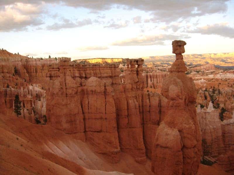
As you hike down towards the floor of Bryce Canyon, you’ll encounter some of the park’s most famous rock formations, including Thor’s Hammer, Two Bridges, and the bottom of Wall Street.
Queen’s Garden and Navajo Loop Trail
- Length: 2.9 miles
- Elevation Gain/Loss: 625 ft
- Time: 2-3 hours
- Location: Sunset or Sunrise Point
If you can’t get enough of the interesting hoodoo formations, then you can combine the Queen’s Garden and Navajo Loop.
This is one of the most popular routes in the park, thanks to the incredible scenery around every turn.
In addition to the amazing views, you’ll get to see the iconic hoodoos from both sections of trail, including Queen Victoria, Thor’s Hammer, and Two Bridges.
You can start at either Sunset or Sunrise Point, but be sure to hike clockwise to net the best views. If you can wake up early enough, try to catch the sunrise at Sunrise Point before you begin hiking.
This is the perfect time of day to start your trek, as the rising sun casts a fiery orange hue across the hoodoos.
You’ll also beat the crowds that are sure to flock here later in the morning if you get an early start!
Tower Bridge Trail
- Length: 3 miles
- Elevation Gain/Loss: 760 ft
- Time: 2-3 hours
- Location: North of Sunrise Point
If you don’t have the time (or energy) to hike the lengthy Fairyland Loop, then consider checking out the Tower Bridge Trail.
This shorter section covers some of the best parts of the longer Fairyland Loop before veering off towards the Tower Bridge - a massive stone structure that indeed resembles a tower bridge.
You’ll also pass by the Chinese Wall (another famous landmark), more hoodoos, and some Bristlecone Pines along the way.
Sheep Creek/Swamp Canyon Trail
- Length: 4 miles
- Elevation Gain/Loss: 800 ft
- Time: 3-4 hours
- Location: Swamp Canyon
If you prefer hiking in solitude, the Sheep Creek/Swamp Canyon Trail is the route for you. The trail traverses through the quieter backcountry area of the park, and few visitors ever see this section of the park.
For the best views, hike this route clockwise in the spring. During this time of year, you’ll encounter a flowing river and carpets of wildflowers bursting with color.
The best part is that you’ll likely have this spectacular landscape all to yourself!
Difficult Hikes
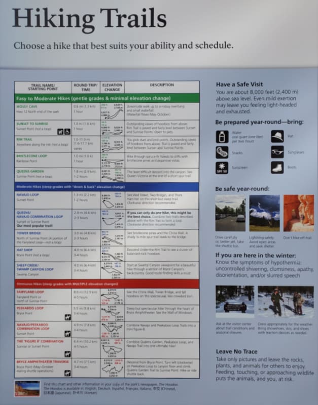
Hat Shop Trail
- Length: 4 miles
- Elevation Gain/Loss: 1380 ft
- Time: 3-4 hours
- Location: Bryce Point
Hat Shop Trail is a backcountry under-the-rim trail that winds past hoodoos and great views of the Praia River Valley and the Kaiparowits Plateau.
The highlights on this route (and landmarks for which the trail is named) are the precariously balanced boulders atop a cluster of boulders - which look a bit like hats.
This is a great trail for those who have conquered other Byrce Canyon hikes and want to get off the beaten path. That being said, this one is a real leg burner and the views aren’t as great as some of the other trails in the park.
Fairyland Loop Trail
- Length: 8 miles
- Elevation Gain/Loss: 1900 ft
- Time: 4-5 hours
- Location: Fairyland Point or north of Sunrise Point
Those in search of a nice long day hike should make a beeline for the Fairyland Loop Trail. This is the longest route in the park, and because of its length it's never overly crowded.
Those who have hiked multiple trails in Bryce Canyon claim the hues of the hoodoos along the Fairyland Loop Trail are the most vibrant.
In addition to the hoodoos, hikers will also pass steep ridges with epic views looking into the canyon below.
Fairyland Loop Trail is not a technically hard trek, but because of the length and elevation, it is a strenuous hike.
If you aren’t up for such a challenging hike, check out the Tower Bridge Trail, which shares a portion of trail with the Fairyland Loop.
Peekaboo Loop Trail
- Length: 5.5 miles
- Elevation Gain/Loss: 1560 ft
- Time: 3-4 hours
- Location: Bryce Point
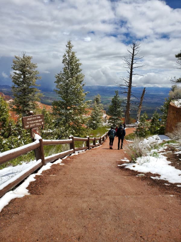
Hike through the heart of the park along the Peekaboo Loop Trail. Named for the blue skies that peak through the rugged hoodoo peaks along the way, the Peekaboo Loop Trail is a favorite amongst visitors.
It’s not as crowded as the Navajo or Queen’s Garden trails, but the views are just as epic. One of the trail’s highlights is the Wall of Windows, but the scenery is stunning along the entire route.
Note that because this is an extremely narrow trail, hiking it clockwise is required. Luckily, this is the most scenic way to do it anyhow!
Navajo/Peekaboo Combination Loop Trail
- Length: 4.9 miles
- Elevation Gain/Loss: 1475 ft
- Time: 3-4 hours
- Location: Sunset Point
Alternatively, you could combine the Peekaboo and Navajo loops to get a taste of both of these beautiful trails. Remember that along the Peekaboo Loop you’ll need to hike clockwise!
Figure 8 Combination
- Length: 6.4 miles
- Elevation Gain/Loss: 1575 ft
- Time: 4-5 hours
- Location: Bryce Point
One of the most epic trails in the park is the Figure 8 Combination. This all-encompassing loop combines three of the park’s best trails: Queen’s Garden, Peekabo Loop, and Navajo Loop.
This double loop takes hikers on a complete tour of the amphitheater and all the glorious vistas that come with it. Remember that along the Peekaboo Loop you’ll need to hike clockwise!
Best Family Hikes in Bryce Canyon
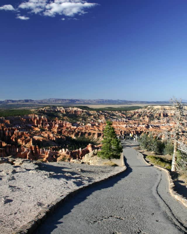
Bryce Canyon is an incredible place to hike but also comes with dangers. Here you can find steep drop-offs, winding canyons that you could easily get lost in, intense weather conditions, and elevation sickness to name a few.
Some of the best Bryce Canyon Hikes for parents include the Mossy Cave Trail, the Rim Trail, the Bristlecone Loop Trail, Queens Garden Trail, and the Navajo Loop Trail.
Generally, these trails are a bit shorter and have enough visual interest for both children and adults
Epic Hikes near Bryce Canyon National Park
The Narrows-Zion National Park
Emerald Pools Trail- Zion National Park
Devil's Garden Trail- Arches National Park
Bryce Canyon National Park Entrance Fee
Park entrance fees are separate from camping and lodging fees.
Park Entrance Pass - $35.00 Per private vehicle (valid for 1-7 days from the date of purchase)
Park Entrance Pass - Motorcycle - $30.00 Per motorcycle (valid for 1-7 days from the date of purchase)
Per-Person Entrance Pass - $20.00 Visitors 16 years or older who enter on foot, bicycle, or as part of an organized group not involved in a commercial tour.
Annual Park Entrance Pass - $70.00, Admits pass holder and all passengers in a non-commercial vehicle. Valid for one year from the month of purchase.
$50.00 for Commercial Sedan with 1-6 seats and non-commercial groups (16+ persons)
$50.00 for Commercial Van with 7-15 seats
$60.00 for Commercial Mini-Bus with 16-25 seats
$150.00 for Commercial Motor Coach with 26+ seats
Learn more about National Park Passes for parks that have an entrance fee.
$80.00 - For the America the Beautiful/National Park Pass. The pass covers entrance fees to all US National Park Sites and over 2,000 Federal Recreation Fee Sites for an entire year and covers everyone in the car for per-vehicle sites and up to 4 adults for per-person sites.
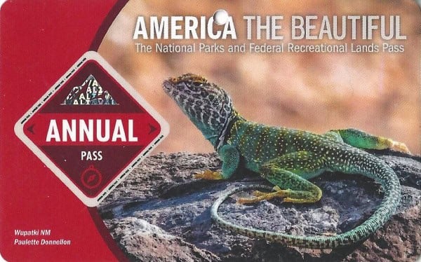
Buy your pass at this link, and REI will donate 10% of pass proceeds to the National Forest Foundation, National Park Foundation, and the U.S. Endowment for Forestry & Communities.
National Park Free Entrance Days -Mark your calendars with the free entrance days the National Park Service offers for US citizens and residents.
Additional Bryce Canyon National Park Resources
The complete guide to Bryce Canyon National Park
Things to do in Bryce Canyon National Park
Bryce Canyon National Park Camping Guide
Lodging near Bryce Canyon NP
Best Western Plus Ruby's Inn - At Best Western Plus Ruby's Inn, you can look forward to a free breakfast buffet, a free roundtrip airport shuttle, and an art gallery on site. Free in-room Wi-Fi is available to all guests, along with shopping on site and a coffee shop/café.
Bryce Country Cabins - smoke-free cabin features a convenience store, a garden, and barbecue grills. Other amenities include a picnic area. All 22 cabins provide conveniences like refrigerators and microwaves, plus free Wi-Fi and flat-screen TVs with cable channels.
Bryce Canyon Inn - Bryce Canyon Inn provides amenities like a coffee shop/café and a restaurant. Guests can connect to free in-room Wi-Fi.
Bryce GatewayInn Cabins - Bryce Gateway Inn Cabins provides laundry facilities and more. Guests can connect to free in-room Wi-Fi.
Quality Inn Bryce Canyon - Quality Inn Bryce Canyon provides amenities like a free breakfast buffet and a restaurant. Stay connected with free in-room Wi-Fi.
If you are looking for lodging close to the park click on the map below to find the current rates for hotels and vacation rentals near Bryce Canyon.
National Park Sites Near Bryce Canyon National Park
Kodachrome State Park
Cedar Breaks National Monument
Make sure to follow Park Ranger John on Facebook, Instagram, Pinterest, and TikTok


Leave a Reply